When North Was Not Always at the Top
Map orientation has never had one fixed rule. Learn why maps put different directions at the top and how to read an unfamiliar layout with confidence.
You unfold an old local map and the river runs across the page in a direction that makes no sense beside the landscape outside. The trouble may not be your sense of direction: map orientation has varied, and north has not always occupied the top edge.
That difference is a clue to what the map was made to do and whom it was meant to help. When an unfamiliar map feels upside down, check its purpose, its labels and its orientation marks before rotating it or assuming it is wrong.
Why North Moved
A map’s top edge is a design choice, not a law of geography. A maker might place a useful destination, a coastline, a route or a familiar approach in the most prominent position, especially when the map serves a particular journey or local audience.
Maps made for different tasks can therefore organise the same terrain differently. A route chart may favour the direction of travel; a town plan may place a harbour or main approach where it is easiest to see. A broad regional map may use a standard orientation to help readers compare it with other maps.
There is no need to treat a non-north-up map as a mistake. First ask what its layout makes easy to locate.
Orientation Clues
Look for a north arrow, compass rose or printed compass directions. These symbols state orientation directly; the top edge alone does not. If there is no arrow, check whether the map gives a graticule, labelled grid, latitude and longitude, or a directional note in its margin.
Place names and recognisable features can provide a second check. A coastline, river bend or road junction may let you match the sheet to a current map, but do not assume that a familiar feature tells you where north lies until you compare its position with a known orientation.
Typography can also hint at how the page should be held. Labels arranged to read from one edge may indicate the intended viewing direction, while labels set at different angles may follow roads or shorelines. Such clues are useful, but they do not replace a compass indication.
When the Sheet Feels Upside Down?
How can I tell which way is north?
Find the north arrow or compass rose and follow its mark, regardless of where it points on the page. If neither appears, compare a clear landmark with a map whose orientation is known, and treat the result as a check rather than a certainty.
Why does the map put a town or coast at the top?
The maker may have prioritised the place or direction most relevant to the intended reader. The layout can make a local route, shoreline or approach easier to follow without changing the real compass directions.
Should I turn the map until north is at the top?
Only if that makes it easier for your task and you can keep the map’s symbols and labels legible. For comparing historical layouts, preserve the printed orientation first; rotating the page can hide the design choice you are trying to understand.
Can I use an old map to find a route today?
Use it to understand how places were represented, not as the sole guide for present-day travel. Roads, boundaries and access can change, so check a current map and follow local access information before setting out.
Common Reading Problems
The route seems to run backwards. This often happens when a map is oriented towards a journey’s destination or approach rather than north. Identify the start and end points, then check the compass mark before deciding that the line or direction is reversed.
Two maps disagree about what is “up”. They may use different page orientations, or one may be rotated to fit its subject. Match a shared landmark and compare the direction marks; do not align the sheets by their top edges alone.
Labels appear sideways or upside down. Some maps angle words to follow a feature or turn lettering towards the intended reader. Read the label in relation to the feature it names, then use other orientation clues to establish how the page is meant to be viewed.
The map has no obvious compass mark. It may be a diagrammatic plan, a cropped sheet or a reproduction whose margin has been removed. Look for a grid or directional wording, and avoid assigning compass directions from page position alone.
Read Purpose First
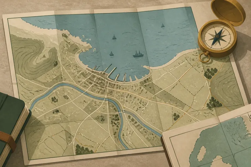
Imagine you find a folded map of a fictional coastal district, with the harbour near the top and no north arrow. You recognise a headland from a current map, then compare the bay’s outline and the road leaving the harbour; if those features line up, you can infer how the sheet is turned, while keeping that inference distinct from a printed direction.
The practical question is not simply “Which way is up?” Ask what the map’s maker wanted a reader to notice first. A harbour map may privilege the water, a route map the journey, and a regional sheet a consistent compass frame. That purpose helps explain the layout without mistaking it for a claim about where north lies.
When you handle an unfamiliar historical map, note its orientation before comparing it with another sheet. Record whether the direction is printed or inferred, then compare the actual features rather than the page edges. Map orientation becomes easier to read when you treat the top as evidence of the map’s intended use, not as north by default.